
Arthur hammers Louisiana; flood threat persists along Gulf Coast
Tropical Storm Arthur battered south Louisiana with heavy rain, flooding, tornadoes and widespread power outages as the first named storm of the 2026 Atlantic hurricane season moved inland after making landfall along the Texas coast.
Arthur briefly strengthened into a tropical storm with maximum sustained winds of 40 mph before making landfall near the upper Texas coast and weakening into a post tropical system.
State and local officials warned that the storm’s greatest threat to Louisiana came from excessive rainfall and severe weather rather than wind.
Flood watches remained in effect across much of southern Louisiana through Friday morning, with forecasters warning that some areas could receive more than 10 inches of rain as bands of tropical moisture continued moving across the state. Flooding concerns stretched from the New Orleans area through the river parishes and into the bayou region.
Emergency officials in several parishes distributed sandbags, monitored drainage systems and urged residents to avoid travel through flooded roadways. In New Orleans, crews deployed flood-control measures and prepared for possible water rescues as rainfall intensified Wednesday night and Thursday morning.
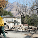
The storm also spawned tornado warnings across portions of southeast Louisiana. In Terrebonne Parish, severe weather damaged property in the Houma area, with reports of roof damage, downed trees and debris scattered across neighborhoods.
In a Facebook post, the United Cajun Navy, an organization formed after Hurricane Katrina that responds to severe weather crises, said its Chief Meteorologist Amy Metz was documenting tornado damage across portions of Metairie.
“Damage assessments have identified downed power lines, trees and limbs as well as structural damage to some buildings,” the post said.
The remnants of Arthur are forecast to move across Georgia and the Carolinas before emerging over the western Atlantic late Friday or early Saturday. While the National Hurricane Center said there is a low chance the system could regain subtropical or tropical characteristics over the Atlantic, officials emphasized that the immediate threat remains heavy rainfall and flooding.
“Regardless of development, heavy rainfall with the potential for widespread and life-threatening flooding is likely across portions of the Southeast United States during the next day or two,” the Hurricane Center said Thursday.


Showers And Thunderstorms
Latest News Stories

Health & Safety Committee: District 3 Board Member Pushes for Expanded Animal Control Services in Monee, Crete

Committee Proposes Incorporation to Block Solar and Data Center Sprawl

Meeting Summary and Briefs: Will County Capital Improvements & IT Committee for Jan. 6, 2026

Legislative Committee: Lobbyists Report on Federal Shutdown and Legislative Outlook
County Authorizes Financial Study of Homer Glen Law Enforcement Contract
Meeting Summary and Briefs: Joliet Junior College Board of Trustees Workshop for January 28, 2026

Will County Public Works Debates Future Bridge Needs as 159th Street Closure Looms

Capital Imp Committee: Health Dept Elevator Repair Costs Significantly Lower Than Estimates

Capital Imp Committee: Veterans Assistance Commission Set to Move into New Facility

Legislative Committee Adopts 2026 Federal Legislative Agenda
Will County Treasurer’s Investment Strategy Yields $6 Million in Income

Lobbyists Outline Strategy for Federal Funding and Grundy County Expansion
Capital Imp Committee Debates ‘Human Factor’ in Drafting New Artificial Intelligence Policy

HBO Max Orders Cop Drama Pilot ‘American Blue’ to Film in Joliet
